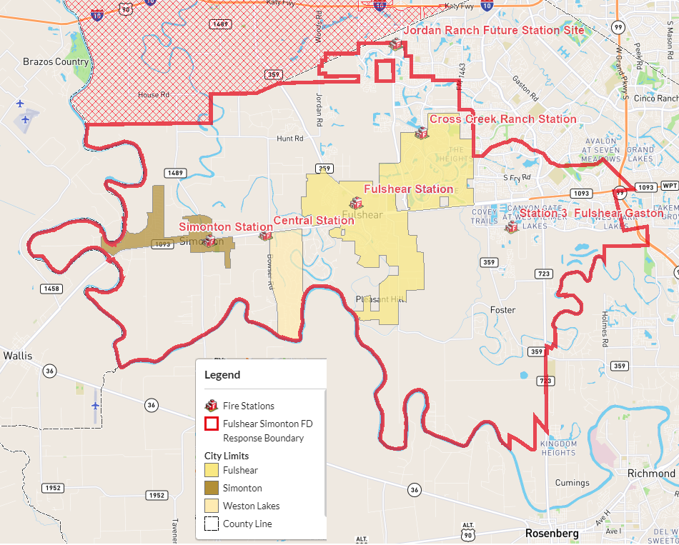
ESD No. 4 was created to include over 106 square miles of territory..
The maps below show FBCESD#4 alongside the other ESD’s in Fort Bend County. Geographically speaking, our service area is the largest of any ESD in Fort Bend County.
Fort Bend County has a great interactive mapping tool that you can use to see the boundaries of ESD’s as well as cities, school districts, and much more. Hint: You’ll need to click the GREEN button at the bottom to show the boundary layers. If you would like to check out the interactive GIS mapping tool for Fort Bend County, feel free to, Click HERE.